Contributors

Subscribe to our newsletter
Sustainable Environmental Consultants (SEC) provides third-party verification and quantification services for the consumer packaged goods sector and the food supply chain sector. To support scale and best in class value-added outcomes for grower participants SEC partnered with FluroSat and TerrAvion to develop these proof of concept tools to illustrate scaling capability in generating sustainable practice metrics.
SEC, FluroSat and TerrAvion are excited to release new sustainability tools to aid in the insights that can be gained from high-resolution TerrAvion imagery and market-leading FluroSense analytics.
To demonstrate the capability of the sustainability tools developed in partnership, the team used public plot trial data from Brandt, Inc.
The field trial dataset can be found here: https://brandt.co/central-illinois
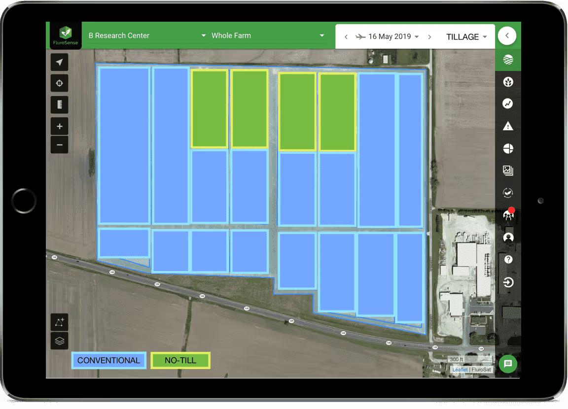
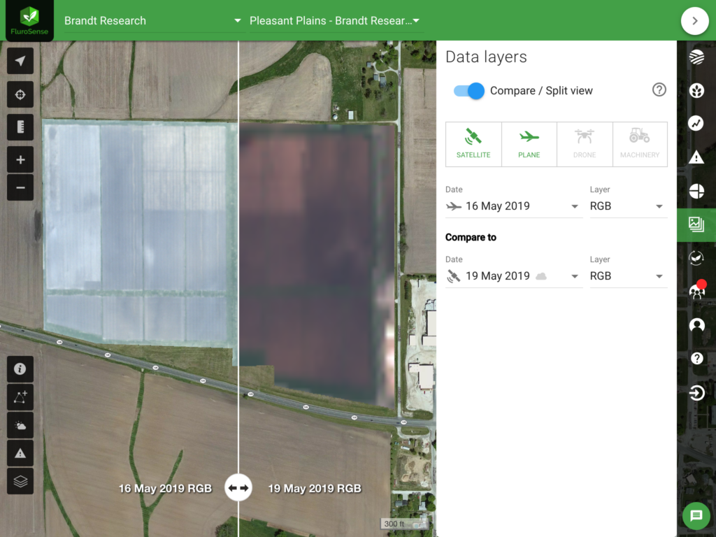
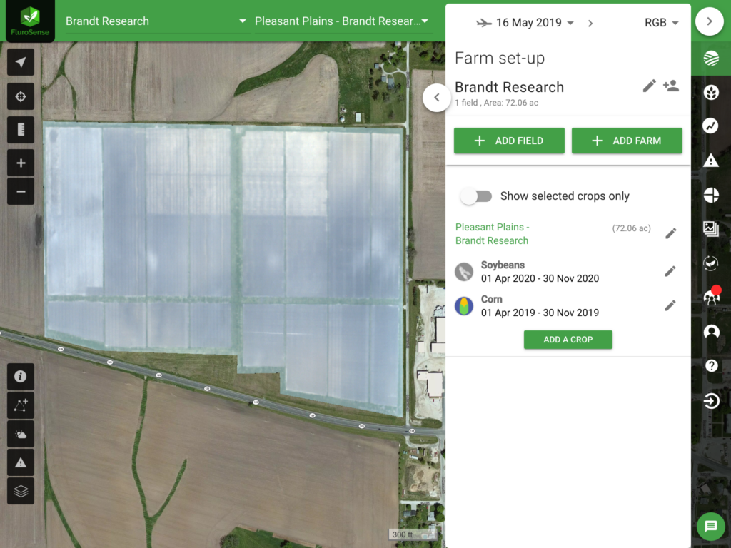
The trial plot in Pleasant Plains, IL was flown by TerrAvion in 2019:
The management information for the plots was consolidated from the Brandt publications:
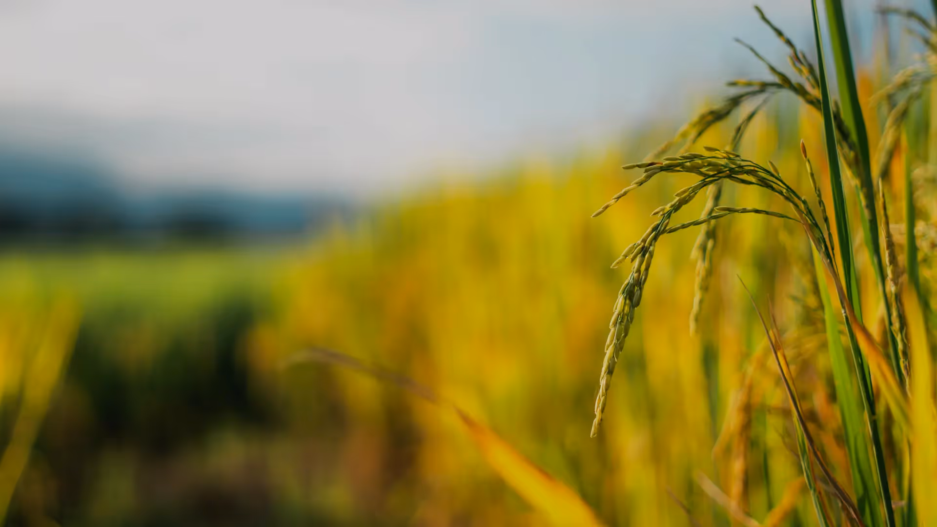
- Crops sown: soybean and corn.
- Sowing date: 2019-05-16
- Tillage methods: No-Till & Conventional tillage
- Image sources: Sentinel 2, Terravion
- Image date: 05/19/2019 (Sentinel), 2019-05-16 (Terravion)
- Bands analysed: R - G - B - Red Edge (X3) - NIR
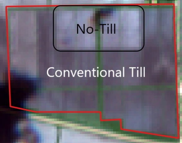
This information was used to set the baseline for the FluroSense platform to run analytics. The goal of this demonstration on the publically available dataset is to show the identification of tillage practices by identifying no-till vs conventional tillage practices.
The concept behind the development of the automated sustainability algorithms in FluroSense relies on "mapping" characteristic reflectances of the no-till” section with its stubble remaining in the field, compared to conventional tillage practice, revealing deeper layers of soil at ploughing.
When combining the Terravion and Sentinel imagery, and making use of all available remote sensing bands (RGB, 3 Red Edge, NIR) the analysis revealed several classes of pixels detected in the image, which enabled training the algorithm for separation between the tillage types.
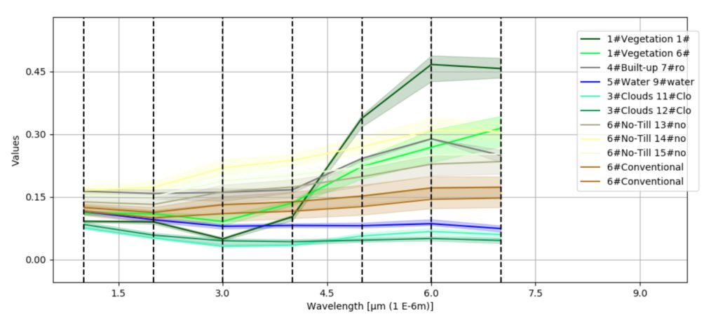
By training the algorithm to recognize and identify the characteristic signatures (example presented in the graph above) of the no-till and conventional tillage practices in both Terravion and Sentinel imagery, FluroSense platform was able to correctly map the tillage practices across the farm.
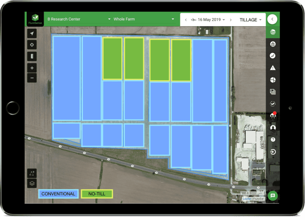
The proof of concept successfully highlighted the partnership between the three companies and the ability to identify management practices, which will enable SEC to support a larger number of growers to access financial incentives from value-added outcomes of their crop management practice.
SEC sees the sustainability tools developed in our partnership with FluroSat and Terravion as a critical component to scale environmental performance and providing a unique service offering in the sustainability quantification marketplace.
If you would like to know more about initiatives supporting growers in implementing sustainable practices and how on-farm data can unlock those incentives, read our CEO's thoughts on using on-farm data to unlock sustainability premiums in the post COVID-19 world.